

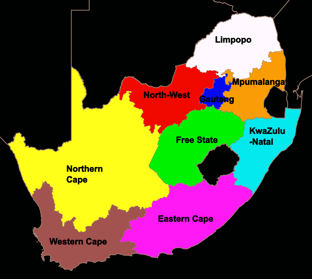
The Constitution of South Africa divides the country into nine provinces, each with its own Premier, provincial members of executive councils and Legislature. The provinces are:
Eastern Cape |
Free State |
Gauteng |
KwaZulu-Natal |
Limpopo |
Mpumalanga |
Northern Cape |
North West |
Western Cape |

The capitals of South Africa's provinces are:
Eastern Cape : Bhisho
Free State : Bloemfontein
Gauteng : Johannesburg
KwaZulu-Natal : Pietermaritzburg
Limpopo : Polokwane
Mpumalanga : Mbombela
Northern Cape : Kimberley
North West : Mahikeng
Western Cape : Cape Town
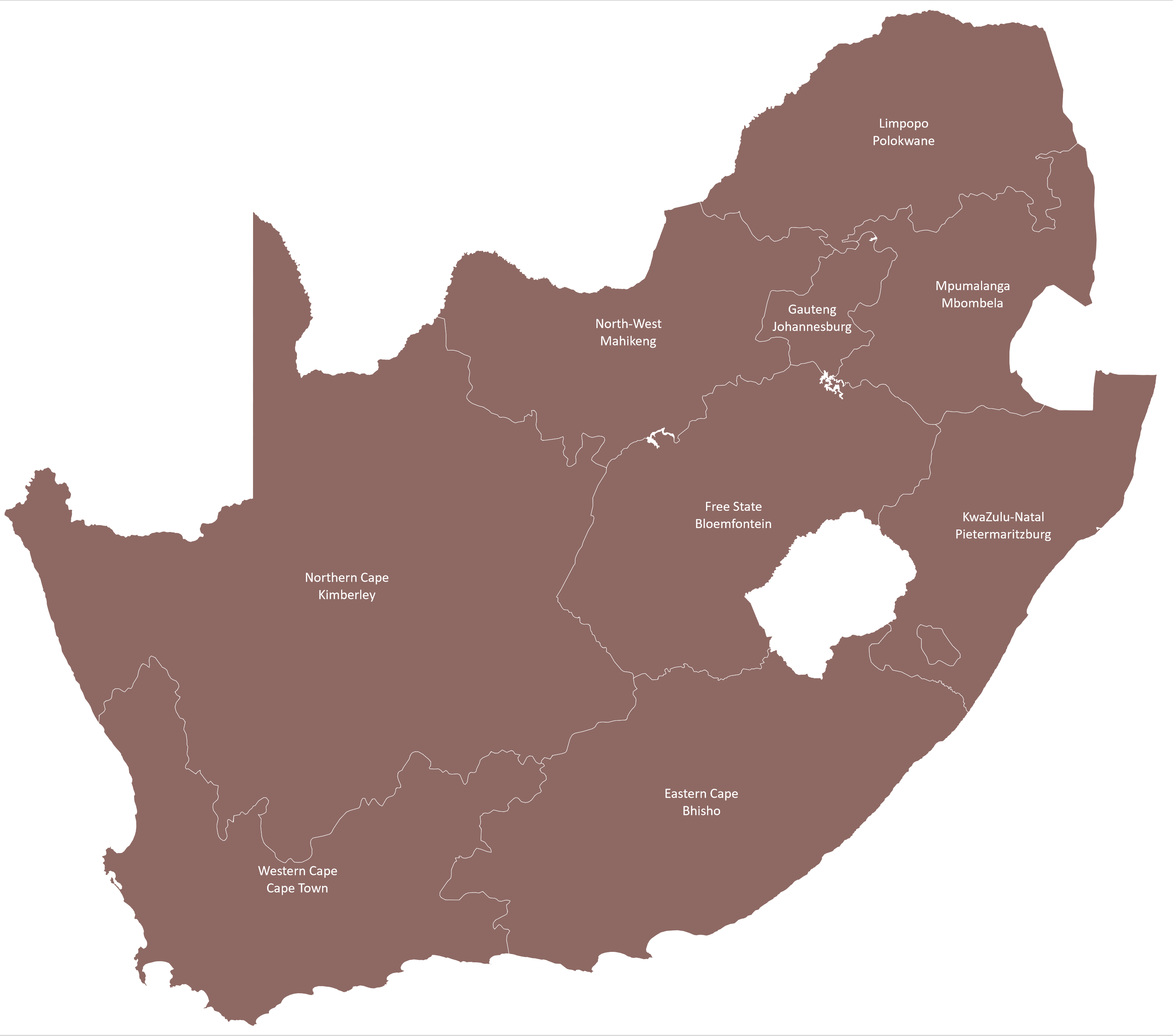
Note that the largest city in a province isn't always the capital city of the province.

The highest points in each province are:
Eastern Cape : KwaDuma (3019m), in the southern Drakensberg.
Free State : Namahadipiek (3291m), in the Maloti Range.
Gauteng : Suikerbosrand Toringkop (1913m).
KwaZulu-Natal : Mafadi (3446m), the highest peak in South Africa (but not southern Africa, Lesotho has a higher peak).
Limpopo : Iron Crown (2126m), there's a hiking trail to the peak.
Mpumalanga : Steenkampsberg / Steenkampsberge (2274m), near Dullstroom.
Northern Cape : Murch Point (2156m), on private land near Richmond.
North West : Slope Point, which is a subsidiary of Nooitgedacht West (1816m).
Western Cape : Seweweekspoortpiek (2325m), in the Klein Swartland.
The lowest point of elevation in each province is:
Eastern Cape : 0m (Coastline).
Free State : 980m.
Gauteng : 914m (Pienaarsrivier valley)
KwaZulu-Natal : 0m (Coastline).
Limpopo : 107m.
Mpumalanga : 89m.
Northern Cape : 0m (Coastline)..
North West : 850m.
Western Cape : 0m (Coastline).
Areas are written on the map and are in square kilometres.
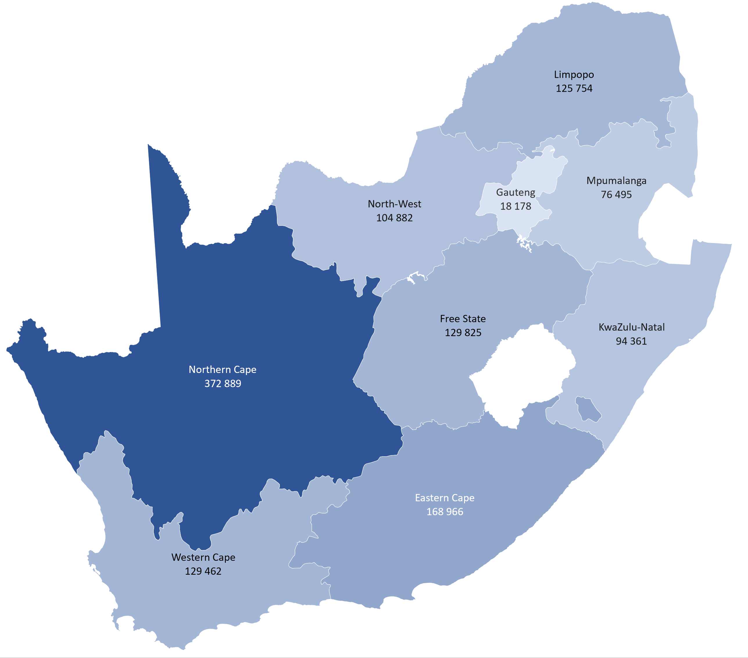
The percentage each of South Africa's provinces make up of the total area:
Eastern Cape : 14%
Free State : 11%
Gauteng : 2%
KwaZulu-Natal : 8%
Limpopo : 10%
Mpumalanga : 6%
Northern Cape : 31%
North West : 9%
Western Cape : 11%
With the names of the provinces in a legend outside of the map:

Check out:

![]()